
2 nylon line
3 parashute
4 nylon line
5 payload box
|
1 Large weather balloon filled with helium 2 nylon line 3 parashute 4 nylon line 5 payload box
|
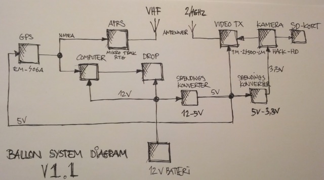
The schematic of electronics (DZL) our first official ballon payload project.
way too complex, too many voltage converters, too much loss, too big and heawy battery
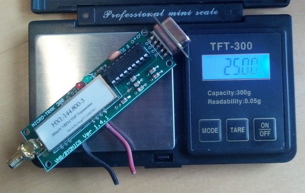
The APRS trak 300 mW ready to go module. (DZL)
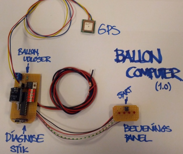
Flight computer, GPS height and distance controlled release system (DZL)
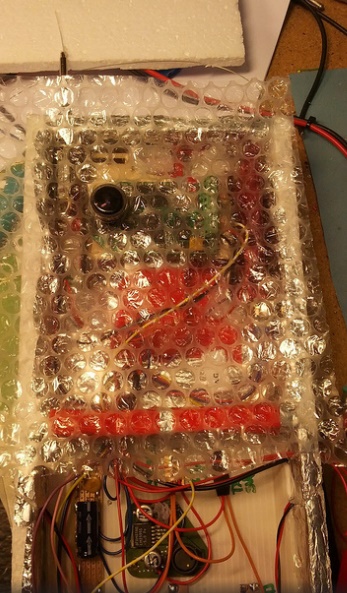
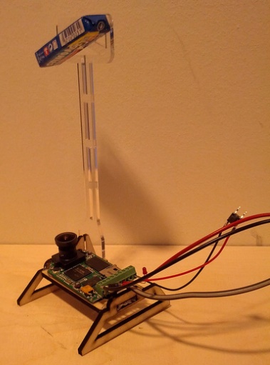
HIDEF cam, visible thru thermal isolation.
just behind the cam in the top is the 2.4GHz video link transmitter.
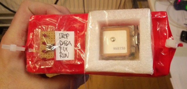
The GPS point up, mossion start button and status LED
The start button store actual height and position, so the mission is ready to go.
This was a "sponsored" project, so here is the name of our kind Sponsor. (DZL)

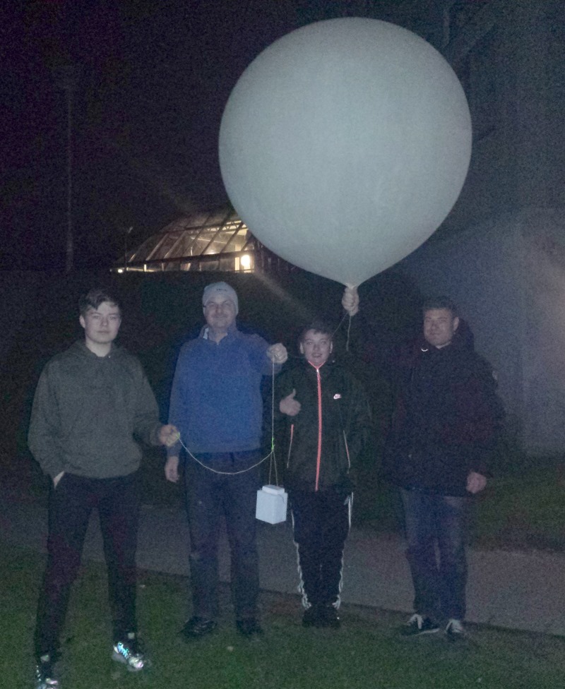
Inflated, and ready to fly. PS: it is not possible to add a sticker to latex,
It barely hold while we took the picture.
RADIO
Live video link using 2.4GHz FM 500mW
Live APRS tracking 144.800MHz FM 300mW
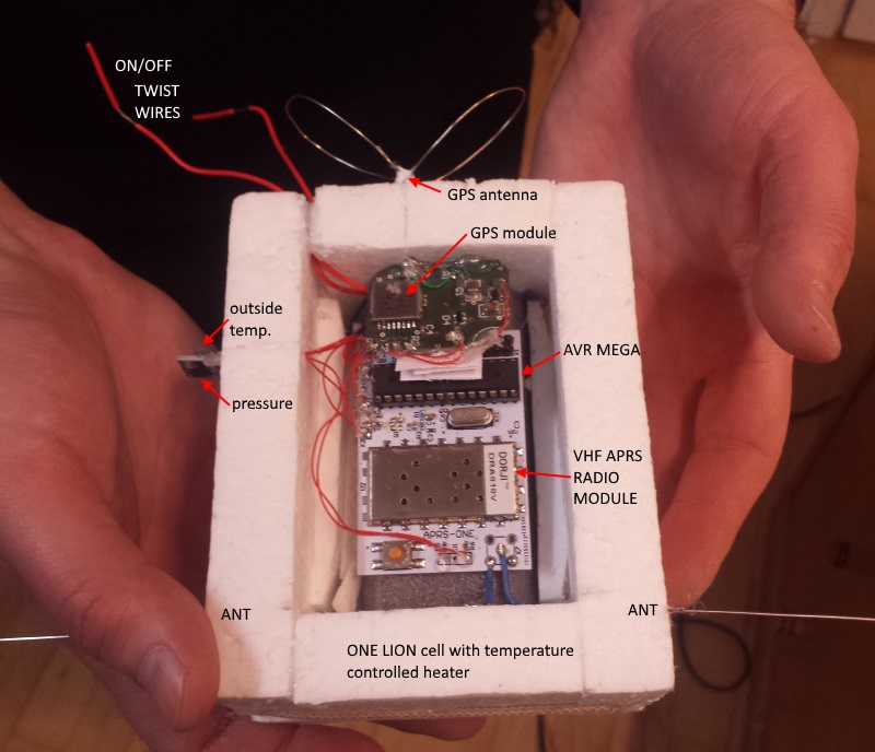
Sensors
GPS position, height.
Air pressure, so height can be calculated if GPS fail (it did)
Temperatures on battery and outside
Battery voltage
other features
HI-DEF video is recorded onboard using SD card, makes recovery opperation more important.
High resolution flight data is stored onboard.
Audio alarm and LED blinker and large light reflector, so the payload can be found easier
Clear name plate with phone number, just in case someone else find it.
As water tight as possible, and as floating on water as possible, and as visual as possible.
Tech data
Balloon : Kaymont military surplus weather balloon, empty weight 600 grams
Gas type used : Helium
How much gas is used : filled to 1.2m diameter
Lift of baloon at ground with payload mounted. 500gr
Parashute area : 1m diameter, decent speed 30 km/t
Payload size : 50 x 15 x 15 cm, weight 499 grams
Total mass at take off : 1099 grams
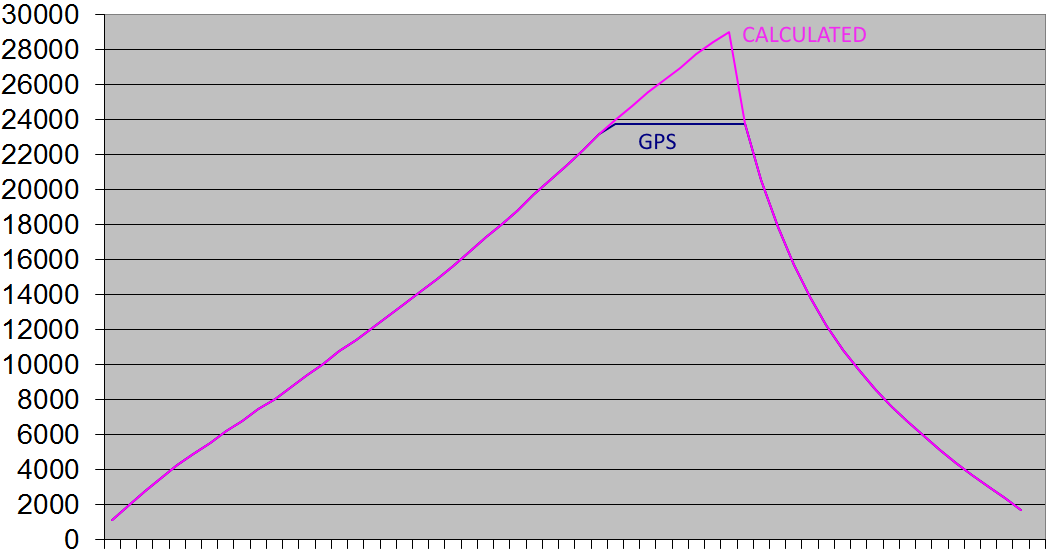
we used a SIRF gps, it maxed out at 23746 meters, AND it send NO FIX codes to the APRS controller
So dont use SIRF units in hight altitude projects.
vimeo.com/64342216 short clip from the LIVE video link 2.4GHz 18000meters height
vimeo.com/64341705 short clip from the LIVE video 9000meters height
So here is a super simple battery warmer circuit, the cool trick is, it draw no corrent at ground.
(at least if you fly at summer time)
And it only keep the critical cell warm, all other electronics run just fine at -50 celcius.
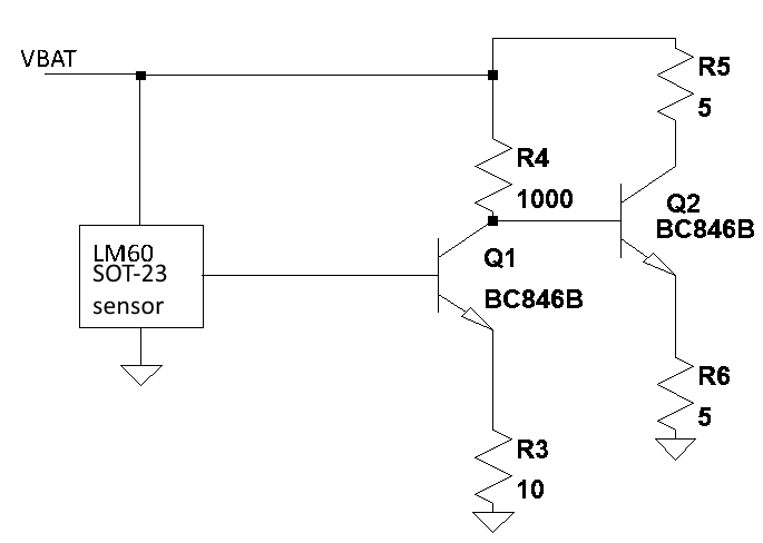
Schematic, for very small battery packs.
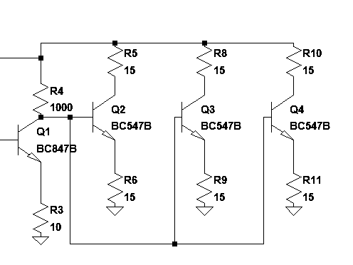
for larger packs, we use 3 times the power, simply by adding more load transistor sets.
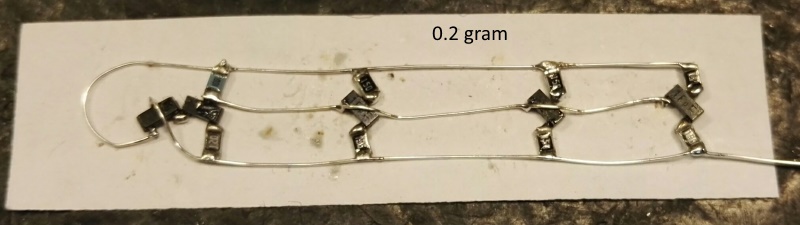
fully assembled temperature controlled heater for very large cells only 0.2 grams
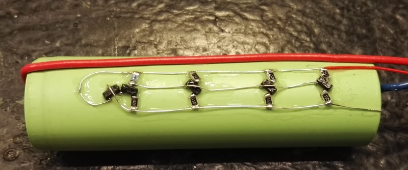
Glued directly on the cell using 10 sec glue.
About the test :
Climatic chamber started at the same time as test, setpoint -40 celcius to simulate poor payload isolation
Battery load format exactly as real payload : 100mA idle, 1000mA for 5 sec every 2 mins (APRS transmitter)
Battery voltage is measured just before current rise, and just before current release, this way internal resistance is easy revealed
Voltage is scaled in excel so 40 = 4.0V simply so all curves are shown in same Y scale.
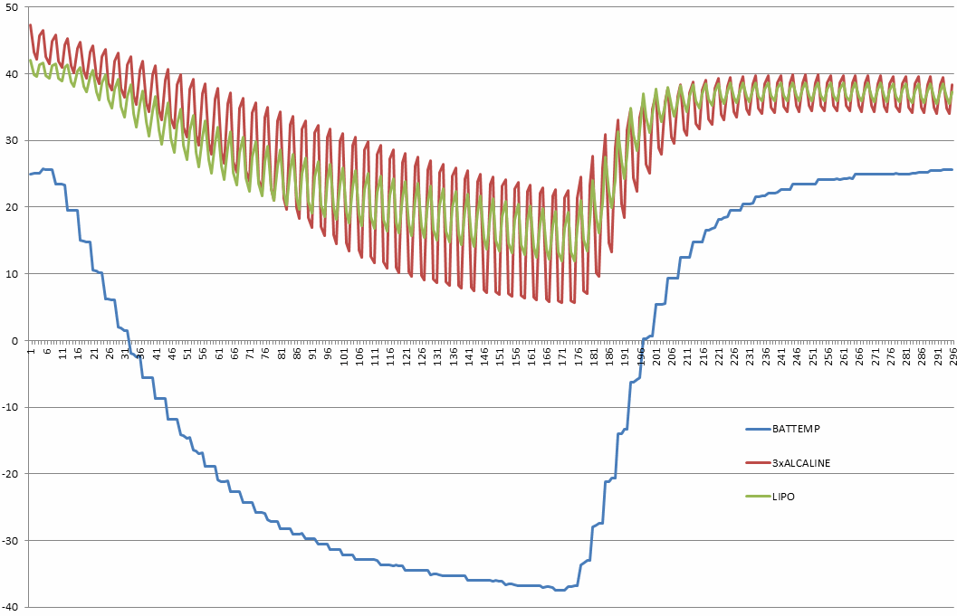
Alcaline versus LIPO
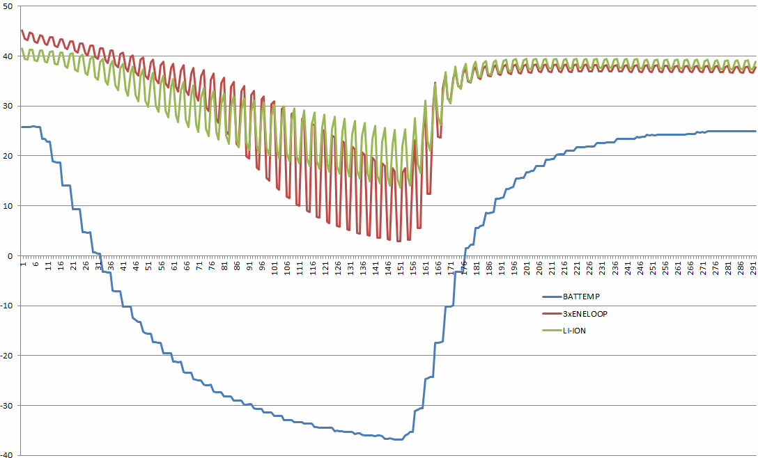
NIMH versus LION
After the first tests it was clear a heater was needed.
at the same time we found a special low temperature cell and compared a heated LION cell with it.
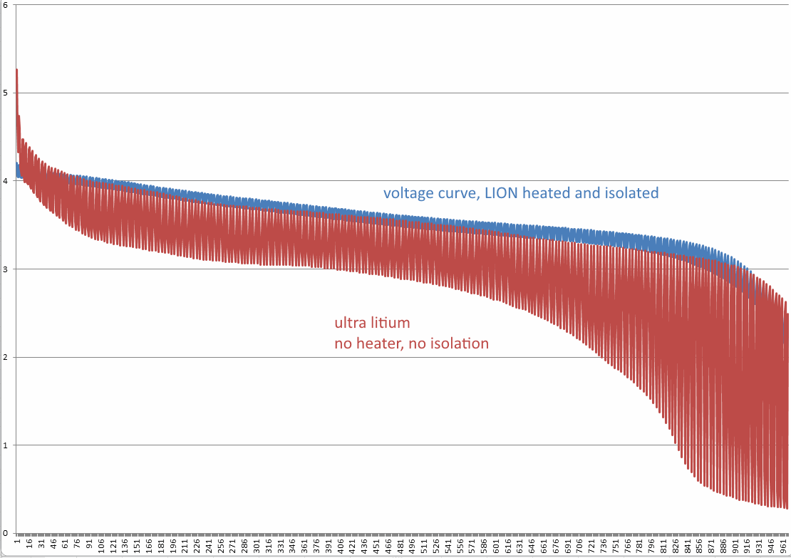
Voltage curve
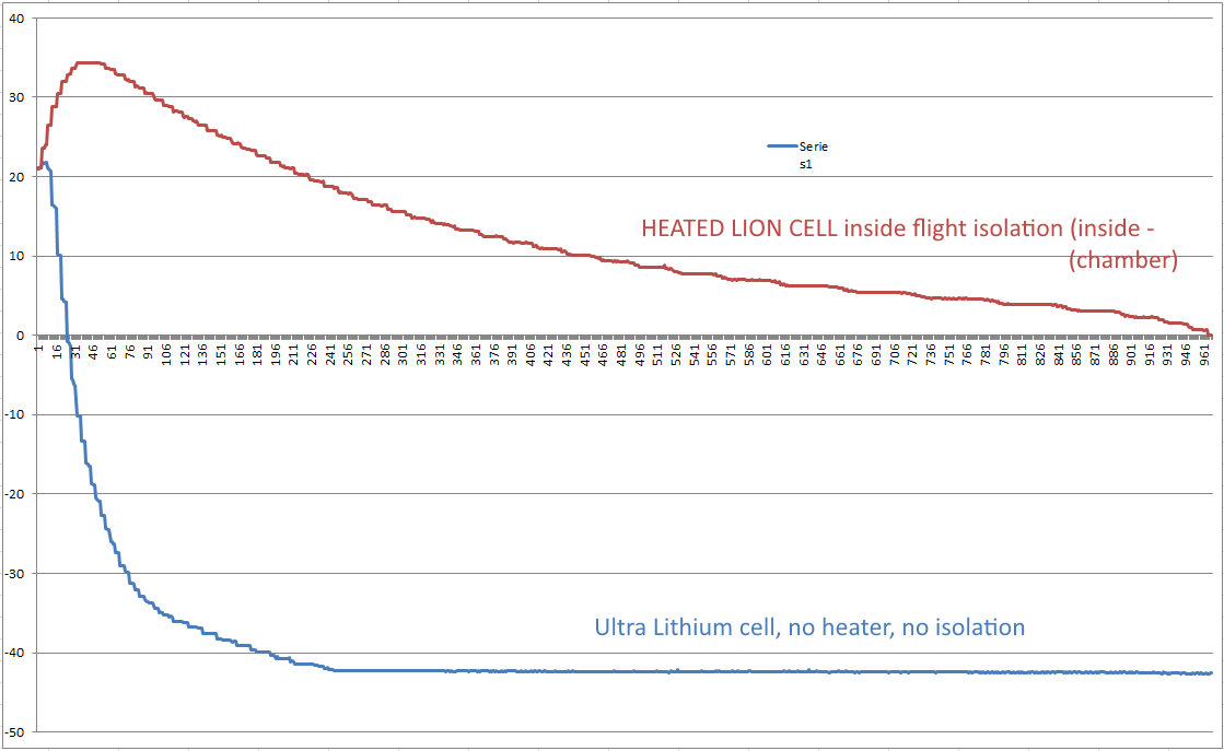
Temperature curve of the two cells inside the chamber, note the temperature peak of the heated cell, a bit too much power/temperature gain
Conclution:
it pays off to use power, to keep the cell warm, total run time of the payload will be much longer with a heated cell.
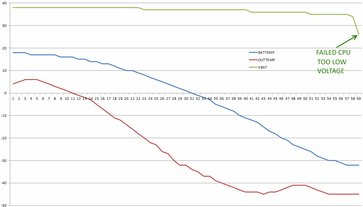
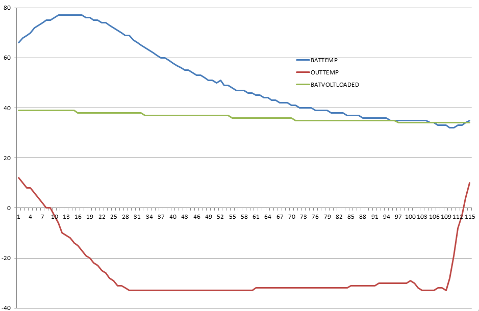
Here only the battery data shown, flight was 4˝ hrs, 32km height
We did two things wrong :
Battery was preheated before flight, NOT NEEDED
Heater was not temperature controlled, just a resistor, nothing more,
this way battery temperature can run wild as shown, waste of power, and also too high temperature is not good for this type of cell
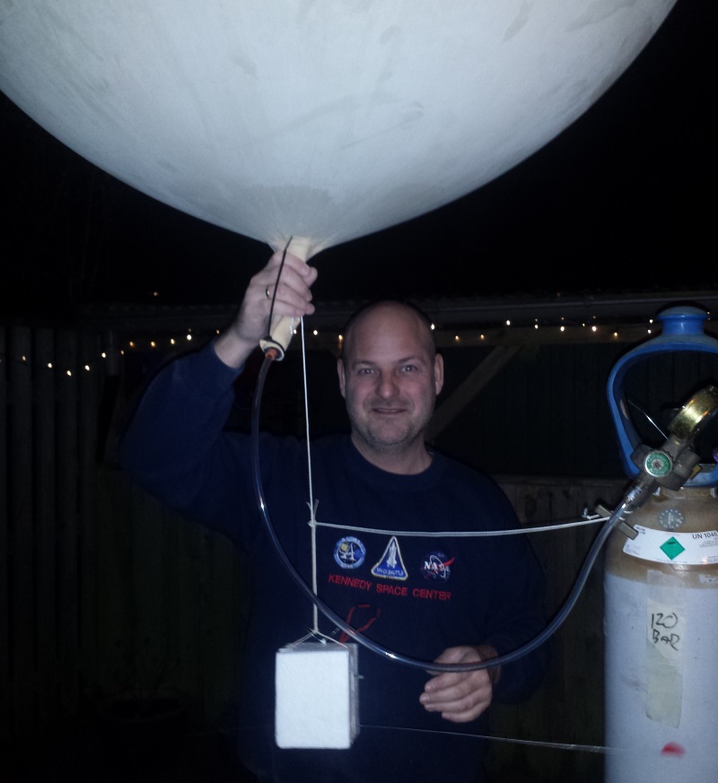
Ready to fly.
Data from actual flight:
Total ground distance 330km.
Flight time 6˝ hrs
Top height 32959 meters.
Lowest pressure measured 11hPa
Lowest outside temperature measured -43 C
Battery 2500mAh LION single cell
Battery temperature system is now perfect and qualified for futher flights
this page dated: 2009 - 2016 - Thomas Scherrer OZ2CPU